October cycle tour map

October cycle tour map

Pages

Saturday, March 12, 2011

Lismore to Colac


Lismore to Colac = 76km
Cummulative total = 1869km
This is my last entry for this blog for quite a while. We have now finished touring for the summer and will take the winter off to watch Geelong get the wooden spoon (probably!!!).

this is a photo of our campsite at Lismore. It is a council park with just your basic toilet and laundry block.

I must admit these 2 look like very wary travellers! I think we are all glad to be back home and when we look back we quit work around 18 months ago and have spent at least 12 of those months living in a tent! Not that we are sick of cycling ... more tired of living in a tent ... I will give myself 4 weeks and then I will wish to be on the road again!
The ride to Colac wasn't as bad as I thought it would be. When we looked at the way to get to Colac without having to go on any highways the route sort of was higgledy piggledy all across the country side! we had to google a route and then take note of the roads and when to turn right or left and at what distance these roads are ... couldn't exactly follow the route of the sun!

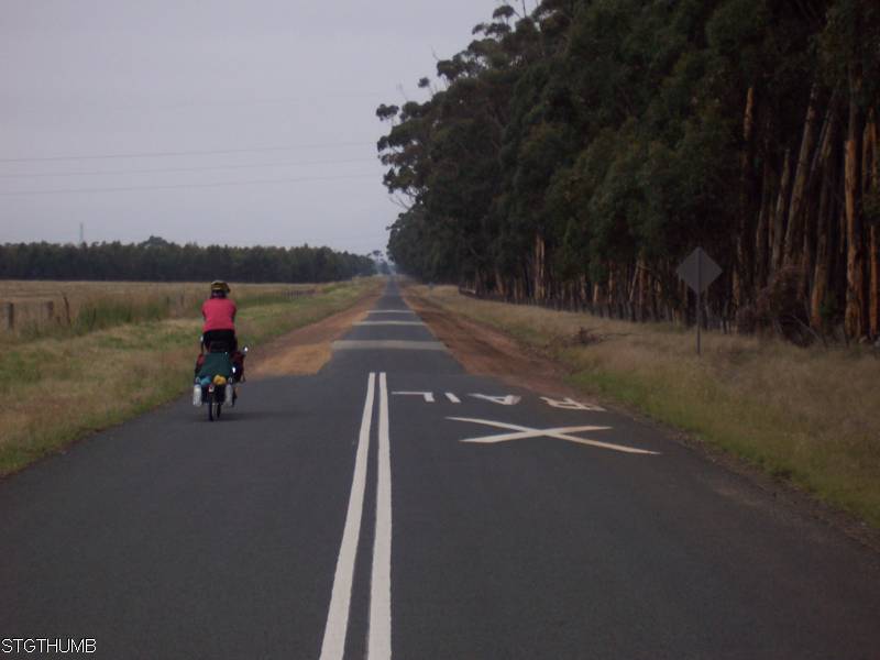
as you can see from the above photo it was a cloudy day and this did not burn off until just after lunchtime. The road was predominantly a single lane and it was fantastic riding and very little traffic.

the country side through and around Corrangamite Lake is very lush and green and the cattle are fat! We saw this old farm building and it is nice to look at but I don't think anyone lives in it.
There was an easterly breeze today - not strong but fortunately for us the bulk of the ride was either to be going east or south. The hardest part was the long stretch of east heading towards Beeac and turning south before it and then it was a cross wind.
We felt good cycling and by the time we stopped for a cuppa at around 40km I was relieved that it wasn't going to be a tough day of headwinds like it was forecasted (it forecasted south easterlies!).
As soon as we pulled over into some farmers driveway because he had a good gate to lean against there was a paddock with some cows that immediately started running towards us!


Kouta wasn't the least bit interested in them so Neil had to pick him up so he could smell them and the cows could smell him.

I think Neil was quite chuffed with the cows I think he was trying to get back to his country boy roots ... me I want to get back to my city girl roots ... namely my craft room!
Just after 40km we turned west and started heading towards Lake Corrangamite on the way there was a farm house with a farm dog waiting for us - we could see him waiting alongside the road .. he was waiting with anticipation for us! What was worse his he was waiting on a hill - so I began to pedal faster with Neil on the outside of me so if he should attack he would attack Neil first! But funny enough he stayed on his side of the road and just ran up and down getting very excited about us approaching. Either he wanted to play with Kouta and was disciplined enough not to approach Kouta or he thought Neil and I looked like cattle and that we had escaped and the dog thought that he might try and round us up!

Here is Neil with Lake Corrangamite in the background - it is not quite full but not as empty as what it use to be! This is a very big lake when you look at it on the map.
Between Lake Corrangamite and Alvie there are plenty of apple trees on the side of the road the first tree we saw the fruit wasn't ripe and then another tree further on had lots of red fruit so we ate one and they we okay. Didn't take any as we knew Ray had some on his tree for me to eat! We did spot a few blackberry bushes but they didn't have much fruit on it but I did manage to pick one or two to have for desserts last night (it went well with my Lemon Meringue!).
At Alvie we had a sandwich and as we cycled out from the rec ground Neil found a $5 note on the side of the road ... he finds money all the time!
From Alvie we go up and a bit behind red rock and somewhere along the road we saw this tree.

it is a tree decorated with bras! unfortunately I couldn't donate a bra as I only had 1 clean one and I needed that one!
Our road came out on the main highway and it was a 2 km cycle to Ray and Flos house and in that time more cars passed us than what has over the past 3 days! being a long weekend it was chockers both ways in colac.
Happy to be home and have a nice fresh meal with delicious desserts and I hear tonights meal is roast chicken with home made apple pie - we did weigh ourselves and have lost a few kgs but by the time we get down to Melbourne I think we would have put it all back on!!!
We will be on the road again proably in October - tentatively thinking about Melbourne to Canberra via East Gippsland and the coast.

Thursday, March 10, 2011

Beaufort to Lismore


Beaufort to Lismore = 61km
Cummulative total = 1793km
It was a miserable day today for cycling - we woke up and it was cold and a misty rain hanging around. We decided to leave and to never return to this place as every time we come here it rains!
The light drizzle did not let up for most of the day - we thought that maybe the drizzle will cease by morning tea as we go lower down but no it was here for most of the day until 40km down the road or around 12.30pm where it was just every now and then. Kouta was not happy that his basket got wet I did manage to put a plastic bag under his shade cloth so that stopped alot of the rain and I also spread his polythene plastic under his basket so that the spray from the road won't come up and wet his basket even more. He doesn't like sitting in his basket when it is wet so he spent a great deal of today standing up! which makes it very sore for me with the constant movement of the trailer you tend to feel it on the lower part of the back - it was a little sore by the end of the day!
Every now and then we did get a break from the drizzle but the wind was coming from the south and it was a head wind and very cold. We both wore our rain coats all day - even when we got closer to Lismore where the weather cleared it was still too cold to take them off!
we had a cuppa at Skipton. The rest stop was next to Emu Creek and you could see where the floods had come through

if you look at the trees to the left you can see brown grass hanging off the trees - this is how high the creek was, so around 2.5-3 meters more than what it is in this photo. It did flood the town as the bridge going over it is at the base of a hill so anything that is in the dip where the hills are got flooded - the pub was being cleaned out when we were here - the lower floor got flooded.
Despite dropping 200m it didn't feel like any down hill today - it was so gradual that with a head wind you didn't really notice it - I thought there was a fair bit of undulations today but that could have been my imagination due to the solid headwind.
Tomorrow is another hard day to Colac - it looks to be very rolling and around 75km - at the moment everything is hanging of the bikes trying to dry!

Wednesday, March 9, 2011

Maryborough to Beaufort


Maryborough to Beaufort = 66km
Cummulative total = 1732km
We had a nice rest day yesterday at Maryborough, didn't do much except chat to NZ and read. We tried looking for the Singer sewing machine museum but all I could get out of Neil was that it was near the old railway station - so we went there but that was closed on Tuesdays and we couldn't see any sign of any sewing machine museum so we are assuming it is in the old railway building which is closed!

it is a lovely old railway building and the surrounding area is really well looked after - they were getting things ready for some sort of opening - we think it might be a new building near this railway station as the entire parkland area looked brand new!

just near the caravan park was a footy field and it had a nice old grandstand.
We got up this morning after a warm night. The day was very cloudy so we checked the radar and there was only a few showers out and about so we decided to chance it and head for Beaufort today.
We took a quiet road that ran parallel to the main street to the road that goes to Talbot - we were going okay until we got to a sign that said the road is closed between 8.30am - 4pm ... it was 8.50am - the have barriers up as it runs between 2 school buildings - so that threw us a bit and we took a side road which didn't go where we thought it would so we got a little lost for a while and eventually found the street again. We went to the main road and stayed on there in case there were any more suprises! The road to Talbot is also one of the main roads to Ballarat so it was very busy, no shoulder, but the traffic was okay. It is up and down to Talbot with 2 biggish but easy climbs.
We got to Talbot and were very relieved to find a smaller and not so busy road to Lexton/Beaufort.
Talbot looked like a nice town with heaps of old buildings - I would have loved to have taken so photos but it was raining so I didn't want to get the camera wet. In fact it had been a light drizzle all the way from Maryborough and the spray from cars got us and Kouta all wet! Kouta was not pleased that his basket was wet!
Talbot had a caravan park in the recreation ground so we might remember that for next time. Neil and I have both found the house we would like to buy (not to sure about the location but definitely the style!) it is situated just after the turnoff to go to Lexton - it was fabulous!

it looks really cosy!
From here Talbot it is a steady up hill climb to just before Lexton - the hill grade is very gradual but you know you are climbing. 3km before Lexton you go down into the town.
We had a cuppa here and saw our Beaufort road - we took this road with a 9km gradual up hill climb to what we guessed was the divide as on the map all the rivers either went north or south. Unfortunately there was no marker to signify the divide - we were a little over the 400m mark above sea level. We were a little disappointed that there was no sign for it as we always take a photo of the divides we cross. From here there is a tiny down hill and then flat to Beaufort.
At Waterloo which is about 10km before Beaufort we took a photo of the divide we crossed.

I am guess the road crossed straight up from the 2nd white road marker from the left - hence the trees are blocking the view! Coming along this road and at this spot you could see the grass that got caught on the fences from the floods - I imagine there was alot of water as the grass is still lying down and the grass on the fences is at the top of the fence. Emu Creek starts around this area of the Divide and goes all the way down to Allansford and out to sea near Warrnambool.

just resting a bit!
We got to Beaufort just before 2pm and came to the campground which is about 1.5km from the town center. I was going to go back and have a look at the 'egg gallery' as recommended by Ray but unfortunately it began to rain not long after we set up tent - so I think I will have to come back another day!
The campground is nice - I can't remember it - I know I have been here but nothing in the park seems familiar. It is a basic park with no kitchen facilities and I am not even sure if there bbq in the campground itself - only one in the public area as this campground is near the footy oval.
We do have a nice spot with a nice view.

this was taken just as the light drizzle started.
One thing I have forgotten to mention is the amount of dogs that have chased us on this trip - I reckon at least every 2nd day we get chased by damn farm dogs! Today was the scariest - we had just come up a hill climb and was just going down it when I heard a bark and looked to my left and saw a farm dog take 2 bounding steps, jump over at least a 1.5m fence and start sprinting towards me! lucky I was going down hill and so had a fair bit of speed, but in saying that this dog was incredibly agile and fast that I looked and saw Neil was too far behind so I had to scream at the dog - usually I panic and squeal but this time I had to make my scream a little more aggressive, but as I said 'piss off' (not that I think it understood what piss off means!) neil also growled at it and it backed off - it must have been about 25m from me when it turned off and thought either it wasn't going to catch me and Kouta or we weren't worth it!
I tell you last year we didn't have too many chases but this trip it is so frequent and believe it or not the damn dogs always do it as you are going up a slignt incline or have a raging headwind that you struggle to pick up enough speed to out cycle them - there was one chase where I was going up a hill and when neil said to pedal faster I had to ride that hill at about 20km per hour to out cycle the dog - it nearly killed me!
Tomorrow we are off to Lismore.

Monday, March 7, 2011

Wedderburn to Maryborough


Wedderburn to Maryborough = 79km
Cummulative total = 1666km
Whew I am glad today is over - it was a lot harder than what I thought it would be!
But first I thought I would take a photo of my current suntan line on the legs ...

I was reading my book in the tent last night and I couldn't help but notice that the light in the tent really made the suntan line obvious! and no mum I am not wearing white shorts under my green shorts!
We got up a little earlier this morning and made a lunch as we knew that we were going to have a longer day than usual. The forecast last night was for northerly winds so we thought that would help us along. Unfortunately it wasn't the northerly we hoped for it was more an easterly and since the road was going in a south easterly direction we had a cross wind most of the day with a cross-head wind to begin with.
The first 22km is up hill mainly on a very quiet Wedderburn-Dunnolly road - hardly any traffic and really only road that is a 1 1/2 car width wide. So it was nice. Along the way up I looked up and saw a black wallaby grazing by the edge of the road - Neil didn't see it until I pointed it out and I wasn't sure if Kouta had seen it - it was about 3m from us when I said that there is one but what suprised me was that it didn't even hear us coming and when it heard me it was just dumfounded and couldn't figure us out and usually they bolt but this one just looked, chewed and then casually skipped off! I didn't get enough time to get the camera out. It is downhill to Rheola and from there the surface of the road becomes quite noticeably bumpy all the way to Maryborough! Just after Rheola you begin to climb again and then down into Moliagul.
It is beautiful riding along here as the road is lined with tall gum trees that offer heaps of shade.
We had a cuppa at Moliagul and this is the birth place of John Flynn the founder of the Royal Flying Doctors Association.


there is not much to Moliagul except for 2 very old buildings - a church and school and off course the memorial to John Flynn. The rest area where we had our cuppa was nice.
From Moliagul it is more open country but nice and lucky for us the wind was blowing a more north easterly and the road was going more south for most of the way to Dunnolly. so that made things a little easier.
we took another break at Dunnolly - we came here last year but decided to push on to Maryborough. We stopped at the small park next to the town hall.

Kouta and I sharing a moment together!

off course any moment between us involves me sharing my food with him!

this is the town hall at Dunnolly. Dunnolly is a lovely old town and is part of the goldfields and all that historic things that go along with the goldfields.
In fact you can tell you are in the goldfields as there are heaps of scrubby trees, stoney ground and absolutely no grass anywhere outside a town!
It is quite pretty country really if you like that sort of stuff. Sometimes you pass historic gold mining area as you can see the slag heaps and sometimes, especially just outside of Dunnolly on the way to Maryborough you can see existing mining area - there was one heavily fenced area that had signs up saying it is a private mining area!
I am assuming all the people in the caravan parks in this area are novice prospectors and have some sort of interest in panning for gold whether it be the old fashion way or the modern way with metal detectors!
Mum if you remember you came in this area once - Ballarat is nearby - remember I dragged you up there because I wanted to go to Soveriegn Hill with all the old time things and you got Caleb that 'wanted' poster? Anyway we are in 'that' sort of country!
Tomorrow we are having our last rest day before we get back to Colac on Friday. 1 week earlier than planned and 10 days earlier than the original draft itinerary!!!

Sunday, March 6, 2011

Boort to Wedderburn


Boort to Wedderburn = 47km
Cummulative total = 1587km

It was a nice ride today - short day so we slept in a bit as we knew we would have some sort of tail wind with us.
left Boort around 9am and travelled east for a few kms and then turned south east towards Wedderburn. We have been on this road before but had travelled the reverse (Wedderburn to Boort) so we sort of knew what was coming.
It is relatively flat all the way to Korong Vale where we had a cuppa. The area is very lush and the fields look good. Not sure how much rain this area got. As you get to Korong Vale the house gardens still look like they are in drought mode! Mind you we only saw 3 people near the pub as we went through town - possibly there is no one in the houses!
From Korong Vale it undulates all the way to Wedderburn with a down hill into the town. We made good time since we had a cross/tail wind most of the way. Just before climbing a short hill I took a photo of Mt Korong.

I have always liked Wedderburn and the campground here is really nice - not great to look at since we are in gold field type areas so if there is rain the grass grows in patches here and there with hard clay type soil in between patches. So when you look at the caravan park you think it is a bit run down but it is not - it has really clean facilities and is is well maintained and looked after.
When we got to the campground we saw a few of the locals that were here last time we came with Dad. The man whose dog died while we were here is still here and he has another blue heeler dog to replace the one that died. The old woman in the corner is still here and she remembered us and there was a couple in a house boat that also doubles up as a caravan on a trailer is sort of here - their house boat/caravan is here and the owner said they will be arriving in a few weeks. The reason why I remember their house boat is the name - D.I.L.L.I.G.A.F. I'm Lost.
We have decided to take advantage of the northerly winds that are blowing and will continue south tomorrow to Maryborough and will take a rest day there on Tuesday. Then 3 cycle days to Colac!

Saturday, March 5, 2011

Quambatook to Boort


Quambatook to Boort = 43km
Cummulative total = 1540km
Las night we went on a short walk around the township of Quambatook and I have to say after 10 years of drought and one serious summer of rain here this town is a ghost town! Although the water from the Avoca river didn't hit the town to destroy houses nearly every third house is up for sale so you can pick up some extremely cheap houses here!

The Avoca river which is a river that goes no where - it starts somewhere north of Beaufort and South of the township of Avoca and stops for no reason at all near Lake Bael Bael which is near Lake Boga - strangely enough the Avoca river doesn't go into the lake but stops just before it!


this is the levy in the middle of a lane on the road - to the left of it is the river and to the right is the town/houses. On the other side of the river is the caravan park and footy field which got inundated with water!

one house (which is up for sale) had a huge olive tree and it was loaded with olives (unripe of course but Neil wouldn't believe me and so bit in to one and quickly spat it back out!).
It was a clear cold night last night and probably the coldest night of our trip so far so it was agony getting out of bed this morning.
We set off around 8.40 and just up the road we saw this field which still had alot of water on it - when you look at it and some of the surrounding fields with water it is hard to tell if it is flooded usable land or an actual lake! Due to the recent floods and rains and water lying around for a while the bird life along the road is absolutely prolific.

It was a very quiet road today and I suppose being a Saturday morning and the road going between 2 small towns there wouldn't really be alot of traffic. We had a headwind again today and at the start it was very strong but by lunchtime it had eased back a bit.
I think alot more of the wheat fields between Quambatook and Boort were damaged compared to those wheat fields north of Quambatook.
We got to town just after 12 and saw the IGA was going to close at 1pm so we stopped and got dinner. I had a lady come up to chat to me and she said they lost all their crop and house and quite a few lost their entire crop as well - compared to yesterday where only a paddock here and there was lost you could see as you rode along alot more flood damage to fields.
We came to Boort last year with dad on our way up north. The campground is on little Boort lake and last april there was water in the lake but not really deep enough for boats which what everyone comes up here for. So below is a photo of outside our tent door ...

and below is a photo taken last april

you probably can't see much difference but the dark strip across the bottom of this photo is sand - in the photo from today the water is right up to the grass - it still can come up further but it would take alot more rain to do that.
So Neil and I can see the difference and at the moment there are a couple of speed boats out there so it is deep enough for them.
Big Boort Lake was empty last time we came here - now it has water in it.
Tomorrow we go to Wedderburn.

Friday, March 4, 2011

Swan Hill to Quambatook


Swan Hill to Quambatook = 58km
Cummulative total = 1497km
As promised we went back into Swan Hill yesterday on our rest day and I managed to get a photo of the giant murray cod ...

we also had a look at the top tourist caravan park that is alongside the murray river and it was just as empty as the caravan park we were in. It has a lovely location and you can see where they had built a levy for the flood waters all along the caravan park and also the adjacent public park land.
I liked Swan Hill and the Riverland park alongside the murray is really nice - they have done a much better job of public access compared to Mildura.
Today we came here to Quambatook and decided against going down to Kerang via the Murray Valley highway - as it was just too busy and the road doesn't have a consisitent shoulder so sometimes you are on the road and sometimes you are on the shoulder and they cars are pretty constant along there. So we decided to risk it and cut across to the Swan Hill/Quambatook road - it wasn't closed like alot of other roads are around this area as we checked on the Vic roads website - there are heaps of roads still closed - like the main one between Kerang and Quambatook - we passed that as we came into town and the makeshift levy is still on the road so it blocks a lane on the road. Not sure how long they will keep it there!
We were so relieved to get on this nice quiet road - hardly any traffic and if there was it was all local. At our first rest break we chatted to one of the wheat farmers (as we used his gate to lean our bikes against!) and he and his brother basically owned all the fields we had just passed (10km back to the turnoff) so he has a rather large farm! He started chatting about the floods and he managed to get most of his wheat cut so he was lucky - there was only one part where it was too wet to cut and they had to leave it. He said the farmers further down were a little less lucky. He was nice to chat to and I tell you he was 77 years old (and he definitely looked alot younger) and is still farming - he has been doing it for 62 years! he said he loved it!
At lunch we were looking for a place to stop and found it hard to find somewhere to lean the bike and we found a road sign pole and I looked up and saw the name of it ...

fancy that - so the mandatory photo is taken! I also had to take a photo of the road we are on - the farmer we chatted to said the road we are on is the longest straight road in Victoria

by the time we got to the dog leg it was 35km on continuous straight - I think he might be right!

above is one of the fields that has been left due to the rain as it was too wet to cut.

and this is what the heads are like - the grains have mould on them - there was just too much wet and not enough sun to dry them out. I assume they will plow them back into the field soon.
It was okay cycling today despite the head wind as it was on a nice road and I would have struggled with the wind and traffic on the murray valley highway!
We got to Quambatook around 2pm and the campground is next to the Avoca river and off course it got flooded - the town was okay due to the levy bank created but the caravan park had water up to the level of the toilet seat (a bit like our lockhart flood last year!) and the bunk houses in the park had 3-4 inches in them. So they are fixing up the place, mainly replacing tiles etc and getting ready for the long weekend where they have a few bookings - today there is only us! and I am sure the caretaker wasn't expecting any tourists! he does have bookings for the bunkhouse for the weekend so he is getting the toilets ready for them.

I came back from a shower and Neil had taken a photo of a bird in the tree above us - he is not sure if it is a Major Mitchell or a Corella - but the 2 of them are noisy!

tomorrow we got to Boort.